Season:Late winter
Weather:Sunny
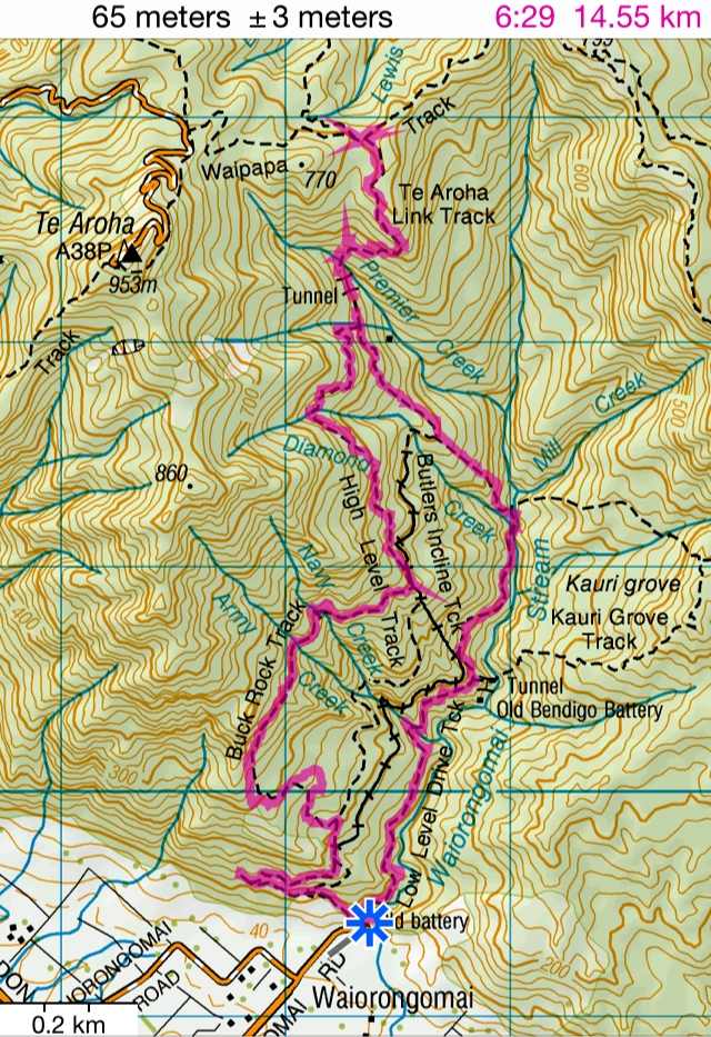
Total Time: 6.5hrs
Walking Time:6.0hrs
Walking Distance:14.6km
Uphill Height:750m
Carpark : Waiorongomai Road
(37°33'37.4"S 175°45'18.9"E) (-37.560378,
175.755249)
Route: Carpark -- High Level Pack
Track -- Fern Spur Incline -- Low Level Drive -- Fern Spur Headframe -- High
Level Pack Track -- Cadman Track (Buck Rock Track) -- Butlers Headframe -- High
Level Pack Track -- Hurdy's Hut (Derelict) -- Piako County Tramway -- Te Aroha
Link Track to Waiorongomai Saddle (EL.700m , Junction with Waipapa Track) -- Return -- Te
Aroha Link Track -- Piako County Tramway -- New Era Branch Track -- Water Race
Track -- Low Level Track -- Carpark
(Note: New Era Branch Track is very steep
with river crossings. The alternative track is Piako County Tramway.)